

Castle Mountain / Rocks
Castle Mountain/Rocks is a difficult but rewarding trail that climbs 648 m into stunning views atop Morrissey Ridge in the Flathead Range outside of Fernie.
Castle Mountain / Rocks
Castle Mountain/Rocks is a difficult but rewarding trail that climbs 648 m into stunning views atop Morrissey Ridge in the Flathead Range outside of Fernie.
Castle Mountain / Rocks
Castle Mountain/Rocks is a difficult but rewarding trail that climbs 648 m into stunning views atop Morrissey Ridge in the Flathead Range outside of Fernie.
Castle Mountain / Rocks
Castle Mountain/Rocks is a difficult but rewarding trail that climbs 648 m into stunning views atop Morrissey Ridge in the Flathead Range outside of Fernie.


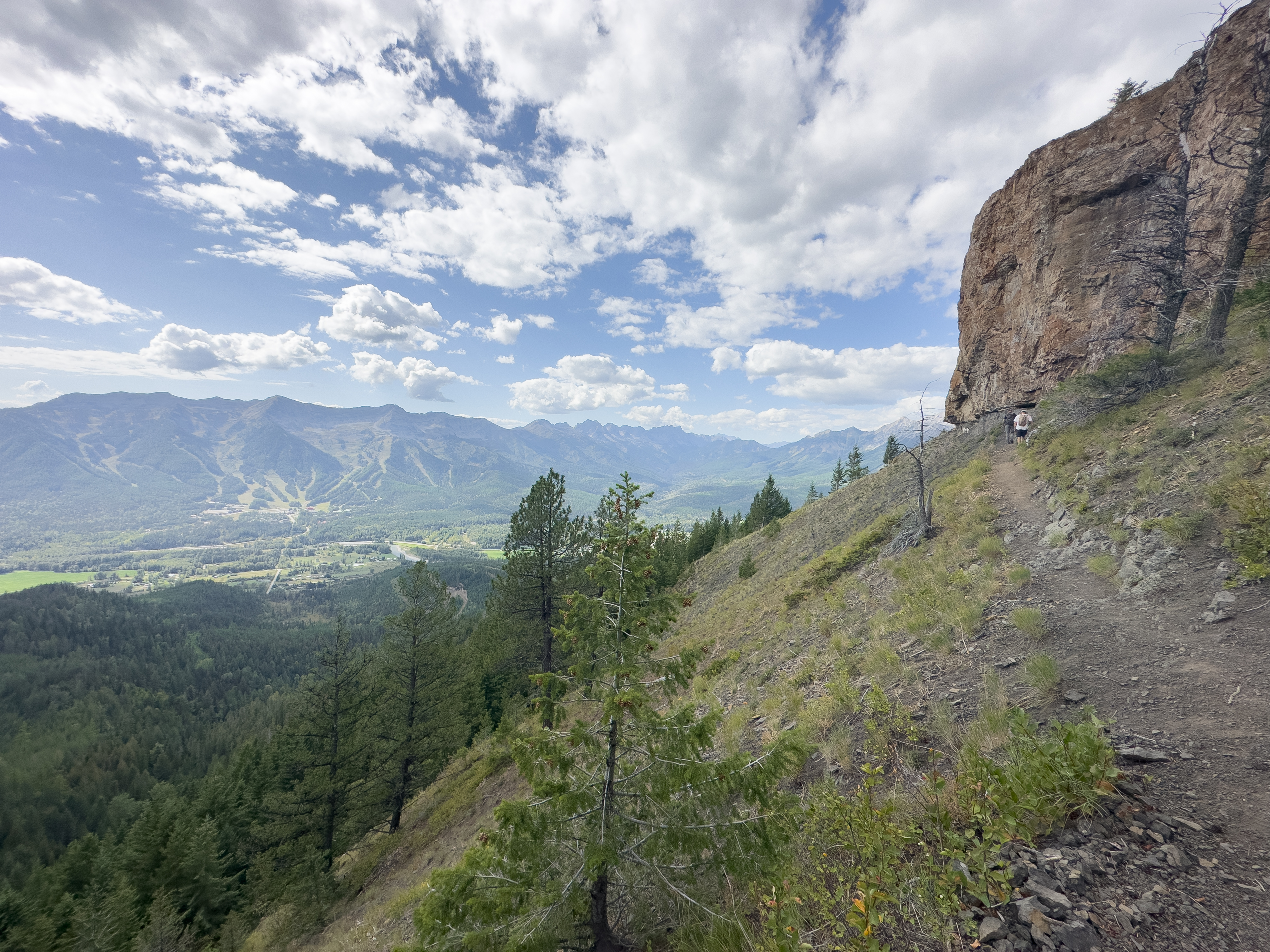
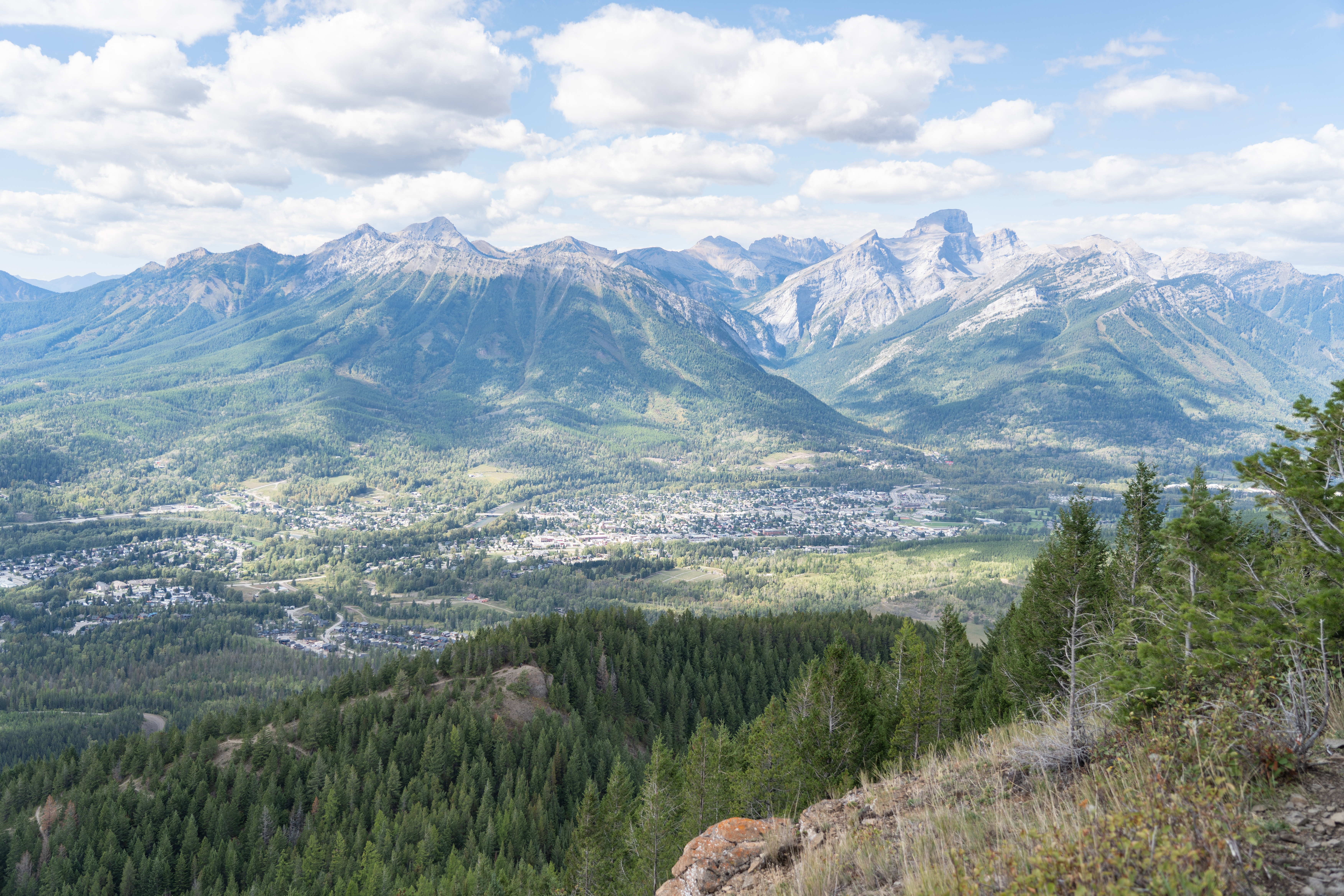
Located along the Morrissey Ridge and part of the Flathead Range of the Rockies, you may have seen the cliff face of Castle Mountain glowing orange in the sunset light of summer. The panoramic views from atop it are even more stunning — spanning out across the valley with the Continental Divide also visible on the horizon on a clear day.
Castle Mountain Trail
Difficulty Level: Difficult
Hiking Time: 5-6 hours
Distance: Approx. 12km return
Elevation Gain: ~ 648 metres
Castle Mountain Hike: What to Know
Trailhead Option 1
Start at the trailhead located on Montane Parkway. From downtown take 4th Street across the train tracks and then turn right onto Pine Ave. Continue straight past the Fernie Aquatic Centre and the small bridge over Coal Creek, then take the first turn left onto Montane Parkway. The trailhead will be on your left with ample parking and a port-a-potty.
Trailhead Option 2
After passing the Fernie Aquatic Centre take the first turn left onto Coal Creek Road and drive for about 2 km until you pass the River Road bridge. There’s a parking lot on the right side of the Coal Creek Road. Cross the bridge on foot and follow the Trans Canada Trail until it connects onto Montane Blue.
This hike starts off pretty mellow and progressively gets steeper. The beauty of it is there are so many viewpoints along the way, and any point you reach is rewarding.
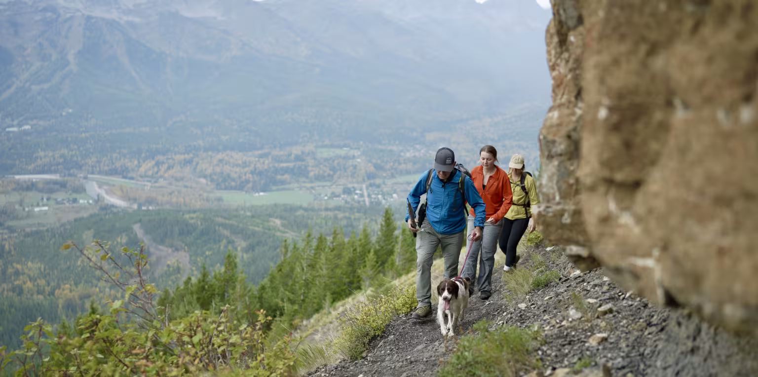
Once you're on the Roots trail, it will eventually joins with Hyper Ventilation Trail. Follow Hyper Vent, and continue to climb up through the forest via the numerous switchbacks. Soon you will reach the first lookout and bench. From here, it’s a few switchbacks before you meet up with Southern Comfort which can take you to the base of Castle Mountain. Once here, take a left and walk the last steep pitch to Castle Mountain’s rocks, a very worthwhile pinnacle. You can also shorten the hike by not taking Southern Comfort and just continue on Hyper Ventilation to the top viewpoint. Take the same trails back to your starting point.
These are multi-use biking and hiking trails so please be cautious of other trail users and be loud for bikers and wildlife.
Yes, dogs are allowed on Castle Mountain trail, however they should be kept on leash and under control, especially with wildlife in the area.
Please make sure to pick up and clean up after your dog, and don't leave the bags along the trail. There is a garbage bin located at the Montane Trailhead, however there are no bins at the other trailhead by the River Road bridge.
There are no water refill options along the trail.
This hike is pretty much accessible all year round. In the winter season, this is a great snowshoe adventure. You can buy or rent snowshoes in town.
Fernie is within the bear and wildlife country, so it’s always good to be prepared. Carry bear spray (and know how to use it), make noise, and stay aware of your surroundings. You can buy bear bells at the Visitor Centre. Bear spray can be purchased at Canadian Tire or some of the bike shops in town.
As with any trip into nature, be well prepared for changes in weather. Remember that you are travelling in an area where wildlife is abundant. Be aware of your surrounding, be loud, follow the proper safety protocols and respect the environment. There are no options to refill your water along the hike, so make sure to pack enough and some snacks too.
Latest Trail Conditions
Trail conditions reports are powered by TrailForks app through information contributed by local and visiting hikers. Please feel free to add and update the trail report if you have completed the hike recently.