



Hero graphic background
Slide 1

Fernie Ammonite Trail

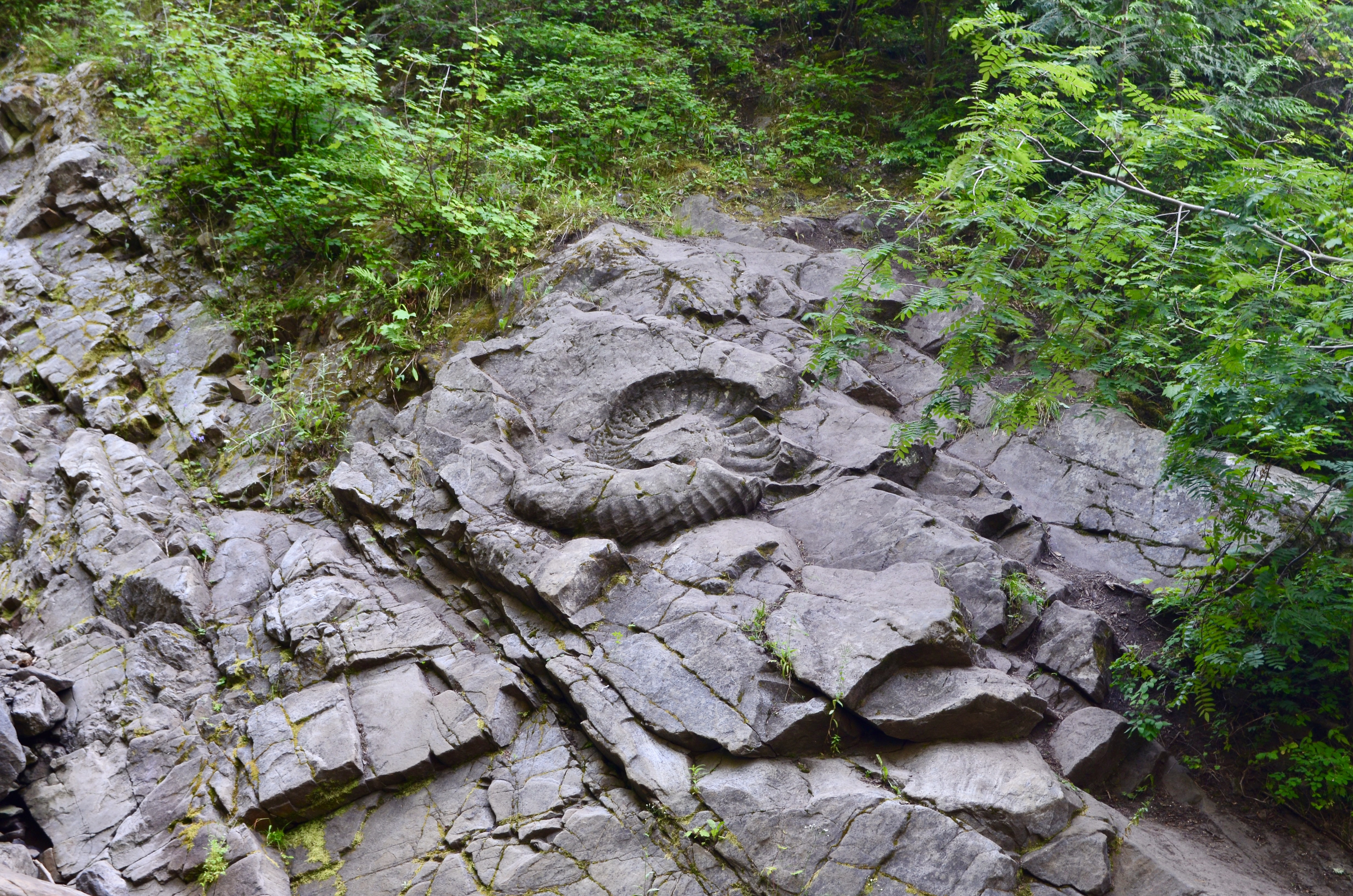
Embark on a journey into Fernie’s remarkable past and see the extraordinary 150-million-year-old fossil still in its original location.

Texture background overlay

Discover an extraordinary giant fossil in its original location on a hike in Fernie. As you visit the Fernie Ammonite, we ask you to help us preserve it for future generations by not climbing on or over the fossil. 

The current trail to the ammonite site is considered moderate in difficulty, with uneven terrain and natural trail conditions that require a reasonable level of mobility and proper footwear. 

This site is part of the broader Fernie Paleo Trail. Scroll down for more information.

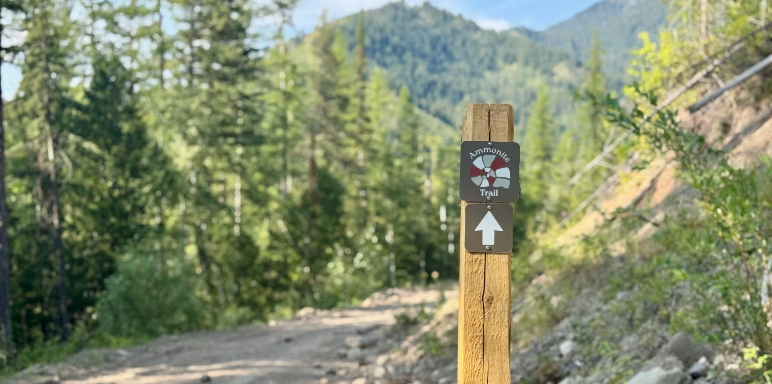
A wooden trail sign to the Fernie Ammonite with a white arrow pointing up, on a dirt path through a forest with mountains in the background.

Fernie Ammonite Trail

Difficulty Level: Moderate

Hiking Time: 2-3 hrs return

Distance: 8 km round trip

Elevation Gain: 255 m

Elevation Loss: 64 m

Fernie Ammonite Trailhead

Drive from downtown Fernie on Pine Ave past the Fernie Aquatic Centre, then take the first left onto Coal Creek Road. Drive for about 2 km until you see a parking lot on your right; park here. 

This is the trailhead for the Castle Mountain, and this is where you start the hike – cross the bridge and follow the signs for the Ammonite Trail. Note there are no facilities at the trailhead nor anywhere along this trail. 

Ammonite Trail Description

For the first 3 kilometres, you will be walking on a decommissioned logging road. Take in the views of the valley; you can spot the Coal Creek Heritage Trail on the other side as well as the rifle range. 

An Ammonite Trail sign will indicate a turn right off the road and onto a single track. This single track section starts with a short climb, then the trail evens out as it winds through a clear-cut, into a beautiful, forested section and eventually through a meadow with berry bushes along the trail. 

After you pass the interpretive sign, exercise caution – the trail descents steeply for a few metres and can be very slippery when wet. You will descend to a creek bed – follow the cairns (man-made stone markers) up the creek. After about 50 metres, the ammonite will be on your right. 

Please observe the ammonite from a distance. You will get the best view and photo angles from standing to the left of the creek – across from the ammonite. The fossil is fragile, and by staying away from it, you are helping to protect it for future visitors and generations. 

Safety & Wildlife

You're hiking in an area with abundant wildlife! Make noise often and keep children and pets close. Carry bear spray and know how to use it. 

Be prepared for weather changes. Have snacks, water, quality footwear and clothes for the weather. 

Stay on the designated trail to minimize impact to the area. Respect the natural settings and leave plants, rocks and other natural objects as you found them. Pack out what you packed in.

Fernie Paleo Trail

Three people gathered around a red table, looking at a map and rocks.

Embark on a Self-guided Journey Through Time

Before the Rocky Mountains formed, Fernie was covered by an ancient sea. Discover the fossils and marine life that reveal this extraordinary chapter of the region's history. Follow the self-guided Fernie Paleo Trail and learn about the 'upside down' mountains of this area. Draw in the whole family through interactive games, engaging videos and more!

Supporting Fernie's Trails

With hundreds of trails to maintain for everyone to explore safely, your support is essential! Most trails are maintained by volunteers through multiple trail organizations. Be sure to buy trail passes and/or donate to the various trail organizations to show your love and appreciation for all the hard work they do!

Fernie Trails Alliance (FTA)

FTA builds, maintains and enhances trails through land use agreements with the Crown, BC Parks, Nature Conservancy of Canada, City of Fernie, Island Lake Lodge and multiple other private land owners to ensure public access year-round. 

Support FTA

Coal Creek Heritage Society (CCHS)

CCHS holds agreements to build, manage and maintain trails on private land in Montane area and core area trails in Fernie Ridge (Ridgemont) for year-round public use. 

Support CCHS