
Mount Hosmer Trail
Travel through 3.5 km of thick, lush flora, slowly transitioning into rocky terrain as you reach the summit. Your reward: stunning views of Fernie and the surrounding area.
Mount Hosmer Trail
Travel through 3.5 km of thick, lush flora, slowly transitioning into rocky terrain as you reach the summit. Your reward: stunning views of Fernie and the surrounding area.
Mount Hosmer Trail
Travel through 3.5 km of thick, lush flora, slowly transitioning into rocky terrain as you reach the summit. Your reward: stunning views of Fernie and the surrounding area.
Mount Hosmer Trail
Travel through 3.5 km of thick, lush flora, slowly transitioning into rocky terrain as you reach the summit. Your reward: stunning views of Fernie and the surrounding area.


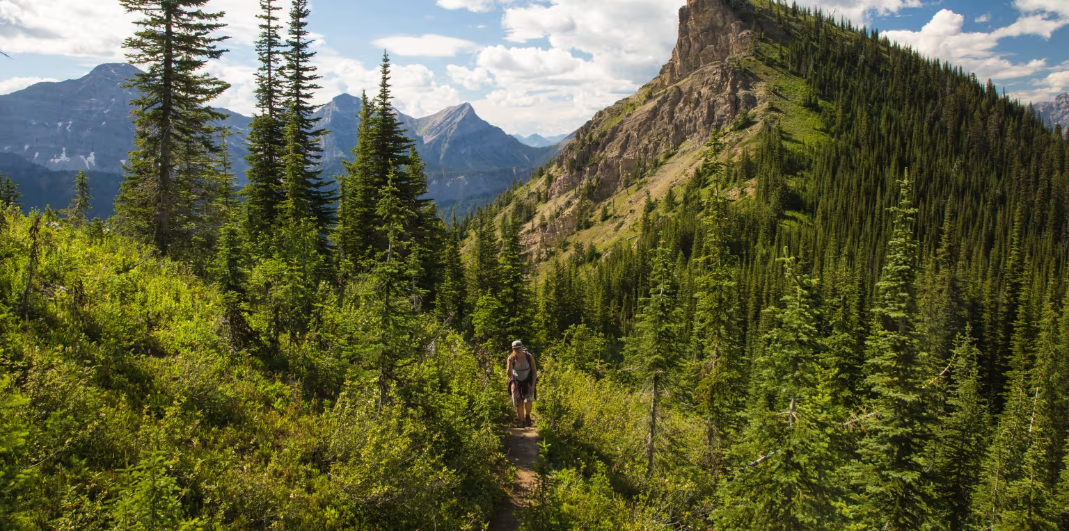
Mount Hosmer (also known as the Ghostrider Mountain) shares its name with the community of Hosmer which is adjacent to the mountain. The mountain is famous for its rough cliff face and is easily recognizable from town. In the summer months when the sun is setting, the shadow of the Ghostrider is visible on the south-facing cliff. In the winter months the mountain's cliff face covered in snow resembles the shape of a St. Bernard / Bernese Mountain Dog's face.
Mount Hosmer Trail
Difficulty Level: Moderate / Difficult
Hiking Time: 2-3 hours to peak
Distance: 3.5km to peak
Elevation Gain: 910 metres
Mt Hosmer Trail: What to Know
Commencing at the bridge over the Elk River on the north end of Fernie, proceed east along Hwy 3 for about 5km and then turn left onto Dicken Road. After about for 600m turn right onto Hartley Lake Road. Follow this rough road for 7 km to the parking area (gravel pull out) on the left, and marked trailhead on the right. High clearance vehicle is recommended for Hartley Lade Rd. Parking at the trailhead is very limited.
This hike is considered difficult.
Mount Hosmer Trail is split into two sections. The first section of the hiking trail follows a narrow path uphill for about 3 kilometres (1.9 mi.). The trail is mostly dirt and earth, with exposed roots and rocks. The first 3 kilometres end at the base of Ghostrider Peak on Mount Hosmer and this section is considered moderately difficult as it includes some switchbacks and steep hills. The second section of the trail leads to the summit of Hosmer Mountain / Ghostrider Peak. It starts off relatively easy and then near the peak it becomes steep. This section of the trail is approximately 2 kilometres. Towards the upper section, the trail navigates along a ridge leading towards the summit. The trail is unmarked and is unmaintained.
Bring sufficient water for the hike as there are no water sources on the trail.
Yes, dogs are allowed on Mt Hosmer trail, however they should be kept on leash and under control, especially with wildlife in the area. Please make sure to pick up and clean up after your dog, and don't leave the bags along the trail. Please note that there aren't any garbage bins located at the trailhead. There is no water available along the trail either.
This is a steep, challenging, and rugged hike that involves scrambling and loose rock toward the summit. Make sure your dog is fit, agile, and accustomed to steep mountain terrain.
This hike is generally available from July to October.
Fernie is within the bear & wildlife country, so it’s always good to be prepared. Carry bear spray (and know how to use it), make noise, and stay aware of your surroundings. You can buy bear bells at the Visitor Centre. Bear spray can be purchased at Canadian Tire or some of the bike shops in town.
No, there are no facilities at the trailhead and parking is very limited. There is no water available along the trail either, so pack plenty.
As with any trip into nature, be well prepared for changes in weather. Remember that you are travelling in an area where wildlife is abundant. Be aware of your surrounding, be loud, follow the proper safety protocols and respect the environment.
Current Trail Conditions
Trail conditions reports are powered by the TrailForks app through information contributed by local and visiting hikers. Please feel free to add and update the trail report if you have completed the hike recently.