
Mount Proctor Trail
This intensive, all-day hike up the 2,393 m Mount Proctor leads adventurers through an array of steep landscapes and rocky expanses.
Mount Proctor Trail
This intensive, all-day hike up the 2,393 m Mount Proctor leads adventurers through an array of steep landscapes and rocky expanses.
Mount Proctor Trail
This intensive, all-day hike up the 2,393 m Mount Proctor leads adventurers through an array of steep landscapes and rocky expanses.
Mount Proctor Trail
This intensive, all-day hike up the 2,393 m Mount Proctor leads adventurers through an array of steep landscapes and rocky expanses.


Scaling 2,393 m (7,851 ft), Mount Proctor is a limestone mountain and home to this popular yet very difficult hiking trail. This all-day intensive hike takes adventurers through an array of steep landscapes, exposed rocky expanses, and a variety of habitats. Please note that dogs are not allowed on this trail.
Mount Proctor Trail
Difficulty Level: Very difficult
Hiking Time: 8-11 hours round trip
Distance: 20km loop
Elevation Gain: 1,500 metres

Mt Proctor Trail: What to Know
Park at the Visitor Information Centre on Highway 3 just east of town. Toilet facilities, bins, and water is available inside the centre which is open daily in summer season from 9am - 5pm. When closed, there is a toilet at the end of the parking lot. The trail starts by the two wooden bear statues and the big trail map sign. Follow the trail markers for the Mt Proctor Hike.
Unfortunately, no! This trail passes into private grazing area for cattle, and that dogs are unfortunately not permitted on this trail due to the safety of livestock.
In short - yes.
This challenging, all-day alpine adventure hike reaches the summit of Mt. Proctor at 2,390m, thus should be started in the early morning. Mount Proctor is an intensive trail allowing hikers to enjoy a full day hike through an array of habitats. This loop trail can be hiked in either direction, however the scrambling section is best done going up versus going down. That means it's highly recommended to hike this trail in a counter-clockwise direction.
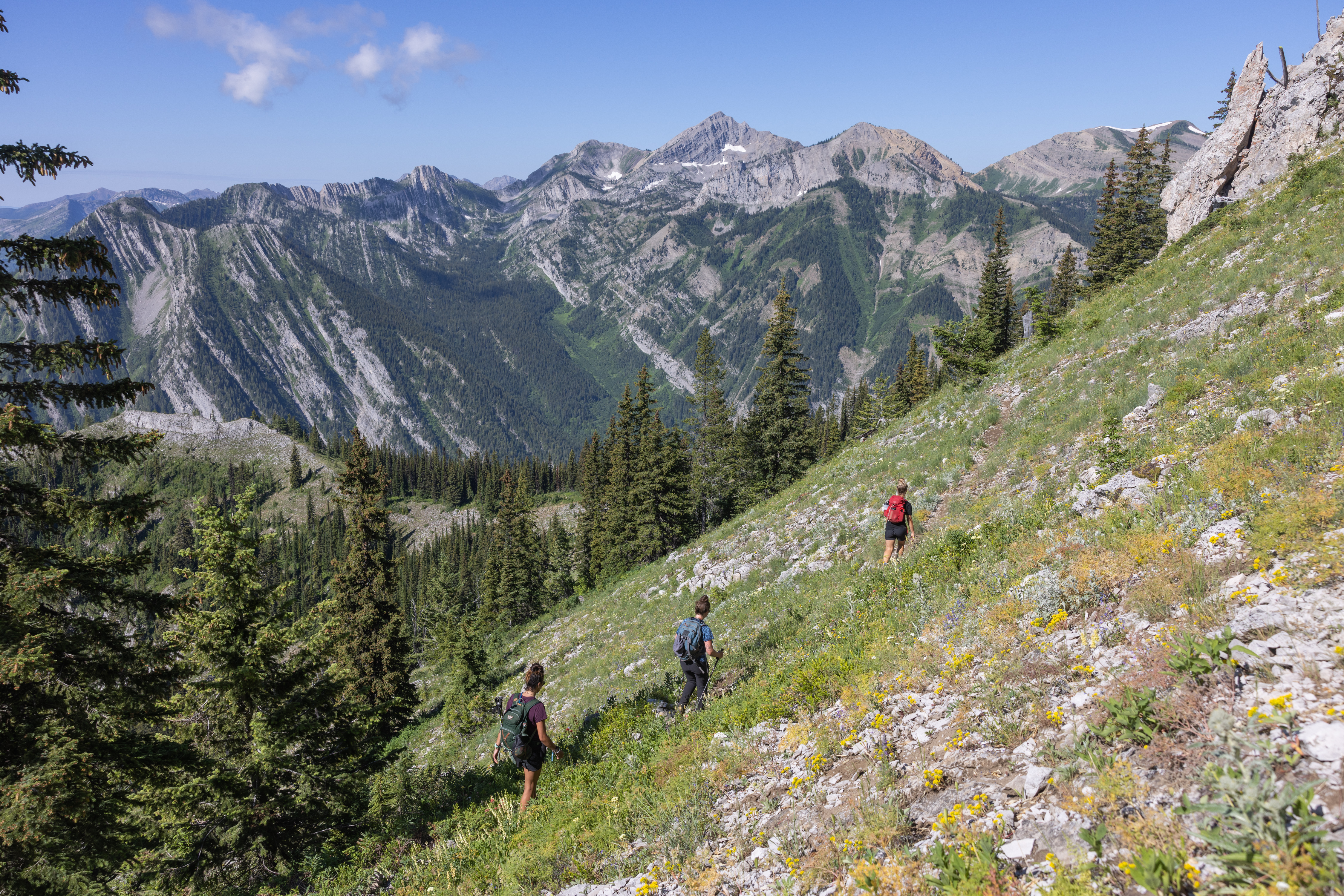
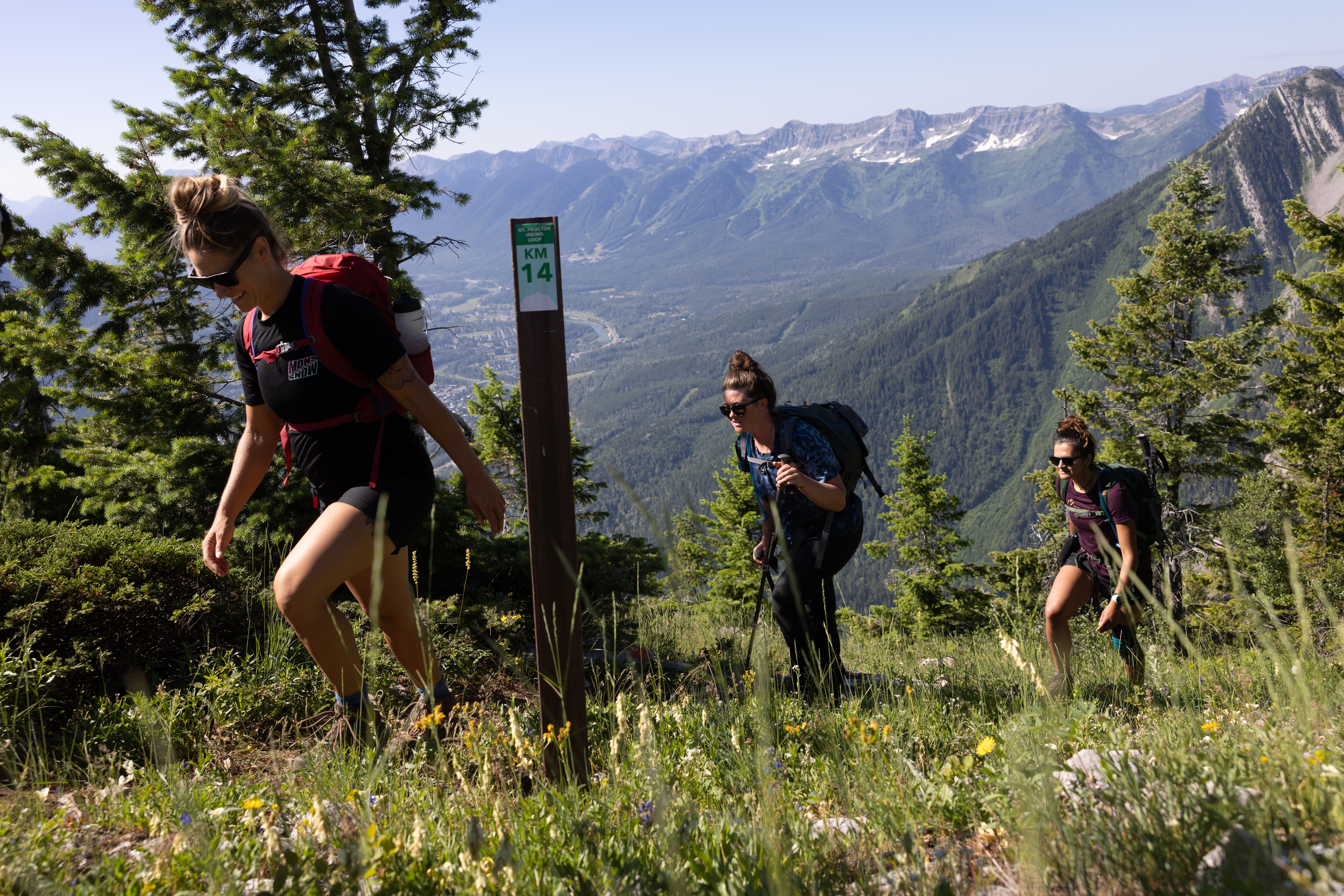
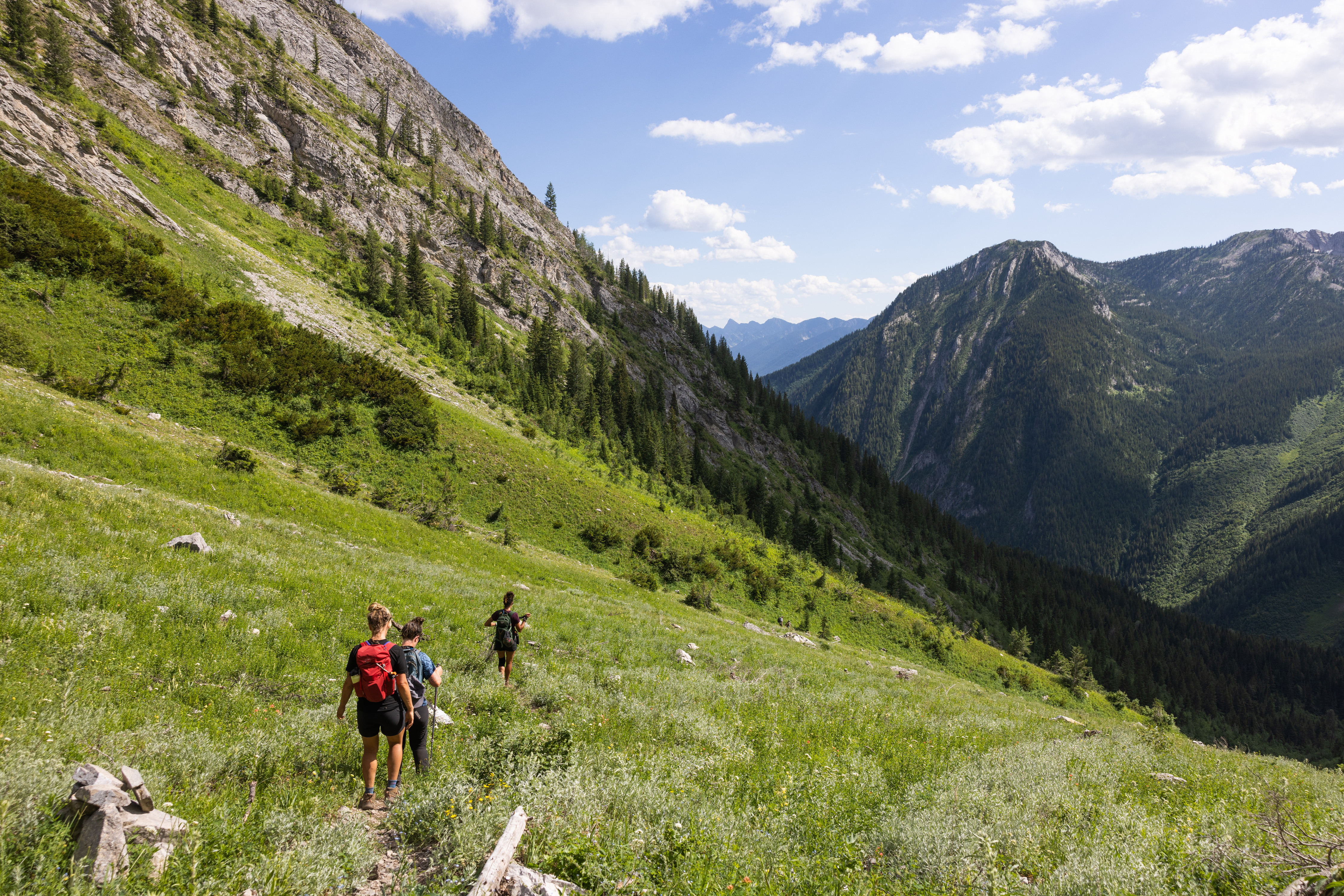
In the counter-clockwise direction the first section of the trail departs from the Fernie Visitor Information Centre via a gentle climb, then connects with Swine Flu trail. Be aware there may be a few cows grazing in this lower section of the trail, as well as mountain bikers riding slowly up the trail. Follow the trail signs for Mt Proctor Trail and continue to the Swine Flu Bench. This is a great rest stop and where you'll be rewarded with a spectacular view across Fernie. After a short rest at the bench, the Mt Proctor trail continues up from the bench. There is another trail that heads down from the bench which is the downhill trail for the mountain bikers only.
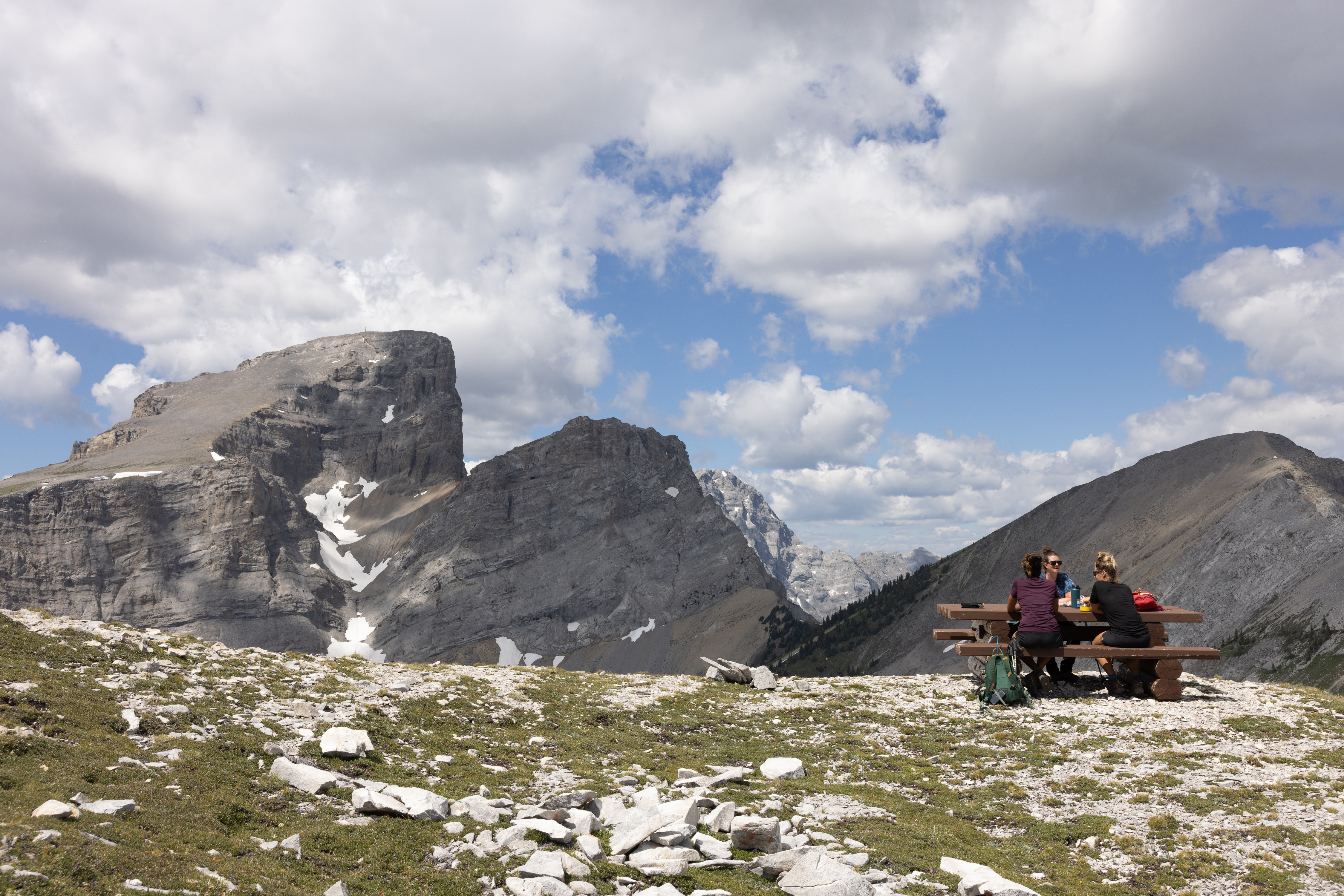
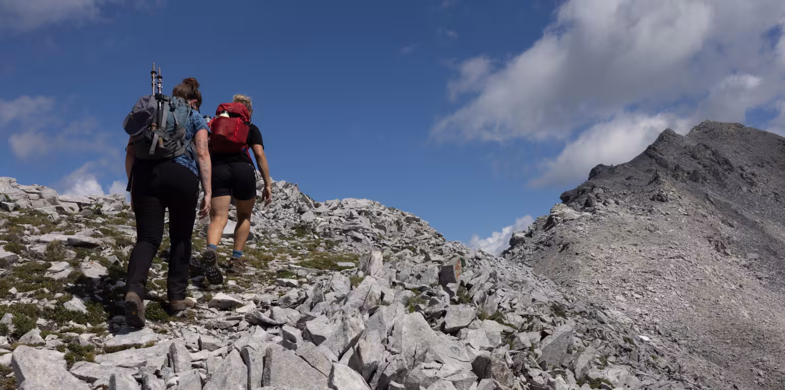
With each switchback, the trees will gradually thin out as you ascend through the subalpine zone. You'll be following alongside the ridgeline high up on your right side as you move towards Mount Proctor's summit. The final approach to the peak will be rocky, loose, shaley and exposed, and will require some scrambling. Have a well-deserved break at the summit and lunch at the picnic bench. The climb is all done.
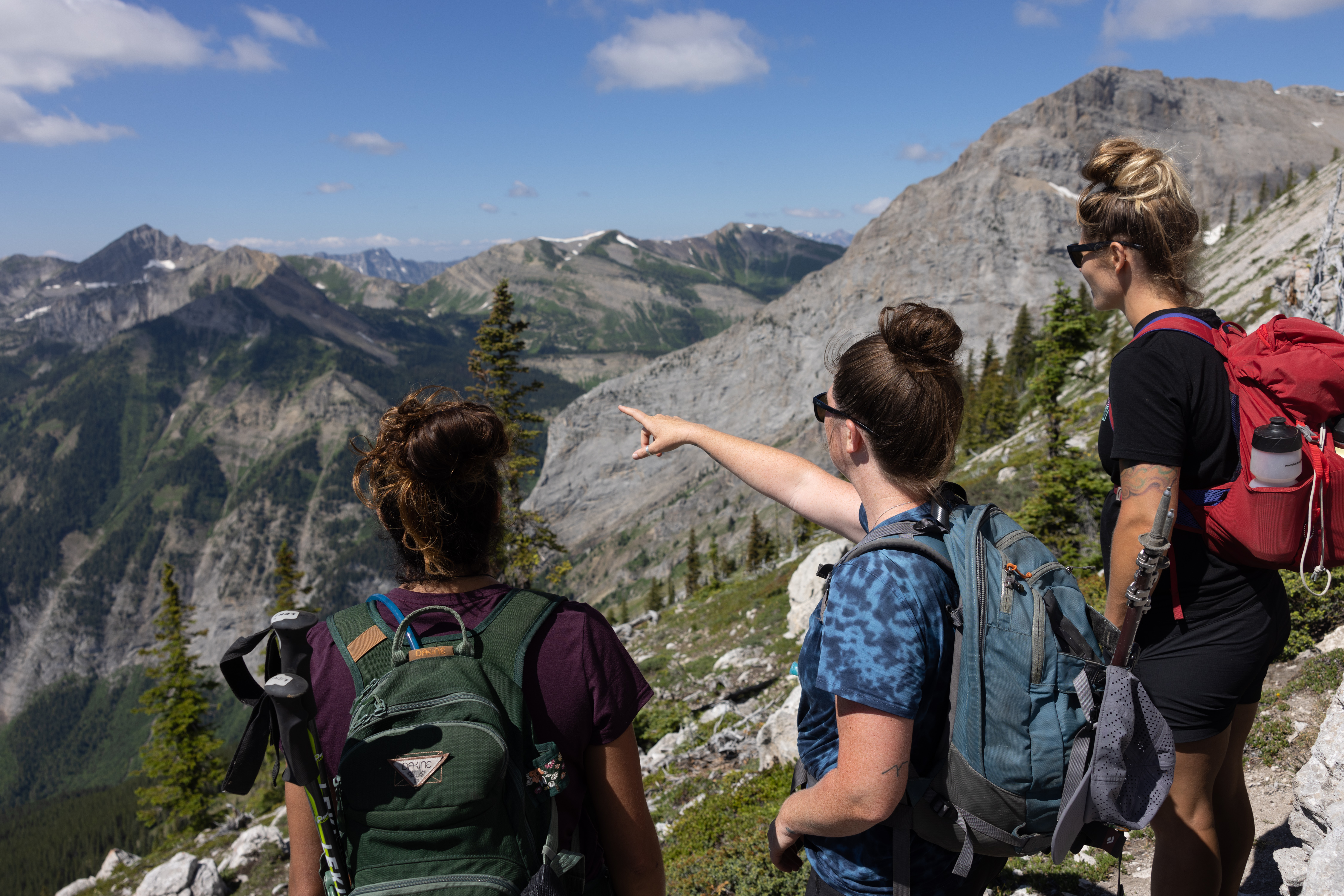
From the summit, continue following the trail north along the ridge. The descent into the valley between the Three Sisters and the back of Mount Proctor is loose and rocky. Signs and cairns will line the trail. A tarn, an alpine lake, is accessible from the trail and can be a great spot to cool off. This lake can dry up late in the season if the summer was long and hot. You'll eventually connect with the Upper Fairy Creek Falls where you'll find a picnic bench viewpoint. From here, you'll head down past the main Fairy Creek Falls and it's a gentle hike back towards the Fernie Visitor Centre.
There are no services or specific camping areas along this trail. 'Leave No Trace' backcountry wilderness tenting is permitted. Please be prepared for backcountry hiking, wildlife and weather changes. There could still be snow at higher elevations, even into July. Route finding may be required if snow is covering the trail.
This hike is generally available from late June through September, with July & August being the prime months.
Fernie is within the bear & wildlife country, and this is a backcountry hike, so it’s always good to be prepared. Carry bear spray (and know how to use it), make noise, and stay aware of your surroundings. You can buy bear bells at the Visitor Centre. Bear spray can be purchased at Canadian Tire or some of the bike shops in town.
As with any trip into nature, be well prepared for changes in weather. Remember that you are travelling in an area where wildlife is abundant. Be aware of your surrounding, be loud, follow the proper safety protocols and respect the environment.
There are no services or specific camping areas along this trail. 'Leave No Trace' backcountry wilderness tenting is permitted. Please be prepared for backcountry hiking, wildlife and weather changes. There could still be snow at higher elevations, even into July. Route finding may be required if snow is covering the trail.
Latest Trail Conditions
Trail conditions reports are powered by the TrailForks app through information contributed by local and visiting hikers. Please feel free to add and update the trail report if you have completed the hike recently.