
Coal Creek Heritage Trail
Newly reopened hiking & biking trail with interpretive signage and a new suspension bridge over Coal Creek.
Coal Creek Heritage Trail
Newly reopened hiking & biking trail with interpretive signage and a new suspension bridge over Coal Creek.
Coal Creek Heritage Trail
Newly reopened hiking & biking trail with interpretive signage and a new suspension bridge over Coal Creek.
Coal Creek Heritage Trail
Newly reopened hiking & biking trail with interpretive signage and a new suspension bridge over Coal Creek.


Hike or bike this newly restored historic trail to the former-townsite of Coal Creek and a new suspension bridge east of Fernie. Whilst completely abandoned now, the small coal mining community was once home to over a thousand residents over a century ago.
Learn about the history of coal and coal mining operations in the Elk Valley, local wildlife, Canada's largest ammonite fossil that was discovered in 1947, and still lies in its original location, and more.

Coal Creek Heritage Trail
Difficulty Level: Easy (See Trail Details!)
Hiking Time: 3-4 hrs one-way (to the Suspension Bridge)
Distance: 10.8 km one-way (to the Suspension Bridge)
Elevation Gain: 301 m
Elevation Loss: 92 m
Trail Head Access
Park at Fernie Aquatic Centre on Pine Ave, the trail head is located at the wooden kiosk by the parking lot.
Alternative trailhead, which would shorten the trail by 2.5 km, is located on Coal Creek road. Continue on Pine Ave past the Aquatic Centre and take the 1st left onto Coal Creek Road. Drive on this road for about 2 km until you see a parking lot on your right. The trail will be just across the road from the parking lot. Please note the parking is limited and there are no facilities at this trail head.
Trail Details
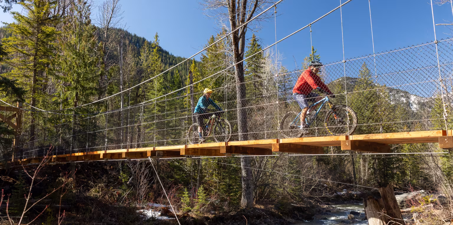
Coal Creek Heritage Trail is officially graded Green / Easy, however please note there are several steep, short climbs along the way. Class 1 e-bikes are allowed, and you can rent them in town. The trail is well marked. Don’t be alarmed when you likely begin to smell an odour of sulphur as you travel further up the trail until you arrive at one of the first old mine portals where a bridge crosses the seepage from the mine. Many old foundation ruins and mining artefacts can be seen along this section of the trail. You are welcome to have a look around, but remember many old mine site hazards may exist off the trail so do so at your own risk. Continue until you reach the new suspension bridge.
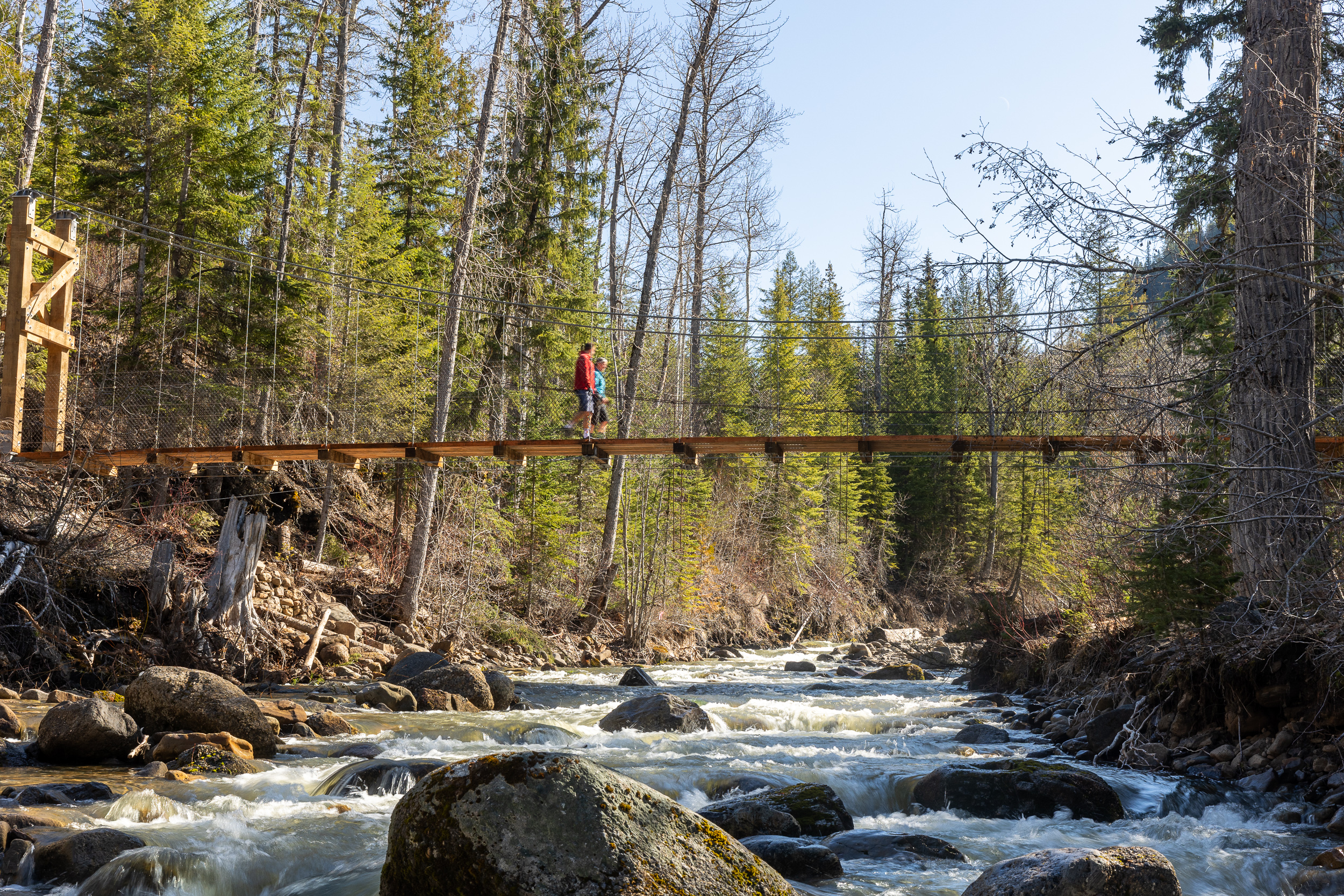
Suspension Bridge
The suspension bridge was completed and officially opened in June 2026. It is built adjacent to the old suspension structure that used to carry a water pipe from Matheson Creek to the old town. From the Aquatic Centre trail head, it take about 3-4 hours / 10.8km to hike to the bridge.
Suspension Bridge Stats:
- 30 m span
- Towers are 6.5 m tall
- Deck is 1.5 m wide
Matheson Falls

If you want to extend your adventure, we recommend visiting Matheson Falls. Cross the suspension bridge and follow the trail to Coal Creek road where there is a road bridge across Matheson Creek. The trailhead to the falls will be on your left. The distance from the suspension bridge to the trailhead is only about 150 m and the fall are only another 600 m away.
This short trail to Matheson Falls is hiking-only, and rated Blue / Moderate due to some ladder features and uneven terrain. If you are on your gravel / mountain bike, we recommend bringing a bike chain lock.
Visit Responsibly
Please note there are no facilities along the Coal Creek Heritage Trail or at Matheson Falls. Please visit responsibly, pack in & pack out, be prepared for changes in weather, carry a bear spray and know how to use it.
Download the Trailforks mobile app for a GPS trail map, to view current trail conditions, and to find and track your position on the trail. In the App search for Coal Creek Heritage Trail (East).