
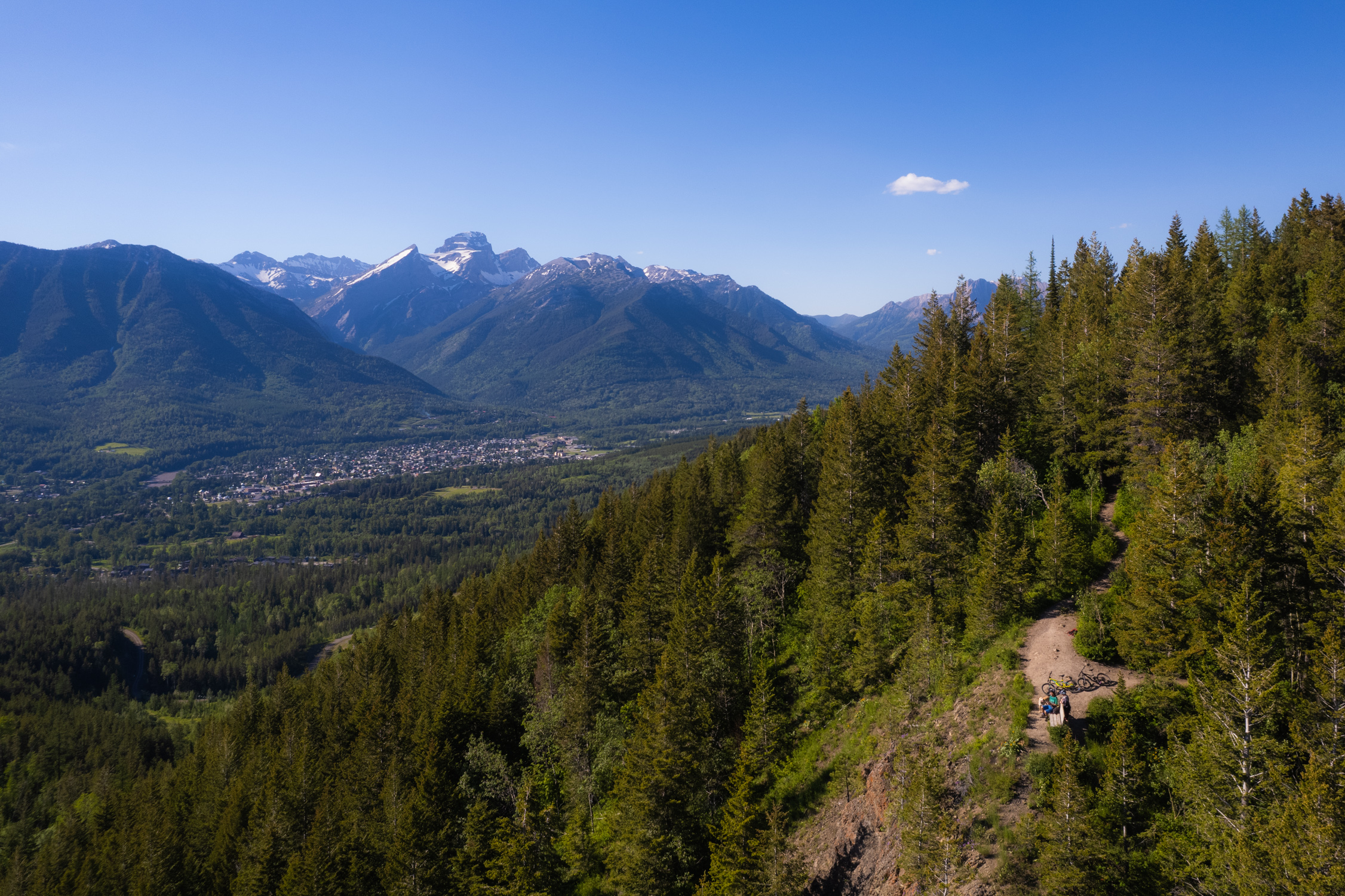
Hyperventilation Viewpoint
The Hyperventilation Viewpoint is a landmark vista point along the way up to Castle Mountain/Rocks.
Hyperventilation Viewpoint
The Hyperventilation Viewpoint is a landmark vista point along the way up to Castle Mountain/Rocks.
Hyperventilation Viewpoint
The Hyperventilation Viewpoint is a landmark vista point along the way up to Castle Mountain/Rocks.
Hyperventilation Viewpoint
The Hyperventilation Viewpoint is a landmark vista point along the way up to Castle Mountain/Rocks.


Ascend through the forested area from Montane Trailhead to reach a small clearing in the trees that overlooks the Lizard Range and across to the Cedar Valley.
Don't forget to pick up a Fernie Trail Map before your hike. The viewpoint is marked as a vista point mid-way up Hyperventilation Trail. Please note, these multi-use trails are also used for mountain biking.
This trail is also a great option for winter snowshoeing.

Difficulty Level: Difficult
Hiking Time: 5 hrs
Distance: Approx 8 km return
Elevation Gain: 350 metres
Hike Details
This route begins as a mellow hike that progressively gets steeper. Follow the Montane Blue trail up to connect to Roots. Cross over River Road Extension and continue up Roots until you come to a 3-way junction where you will join with Hyperventilation Trail.
Follow Hyperventilation upward for approximately 800m. You will continue to climb up through the forest and via the numerous switchbacks. Soon you will reach the lookout point bench. Take the same trails back to your starting point.
There are options to refill water on this trail. Be sure to bring enough for the hike.
Trailhead Access
The trail begins at the Montane Trailhead. From downtown, drive past the Fernie Aquatic Centre on Pine Avenue, cross the small bridge and take the first left onto Montane Parkway. The trailhead will be on your left with ample parking and a portapotty.
As with any trip into the backcountry be well prepared for changes in weather. Remember that you are traveling in an area where wildlife is abundant. Be aware of your surrounding, be loud, follow the proper safety protocols and respect the environment.
Current Trail Conditions
Trail conditions reports are powered by the TrailForks app through information contributed by local and visiting hikers. Please feel free to add and update the trail report if you have completed the hike recently.